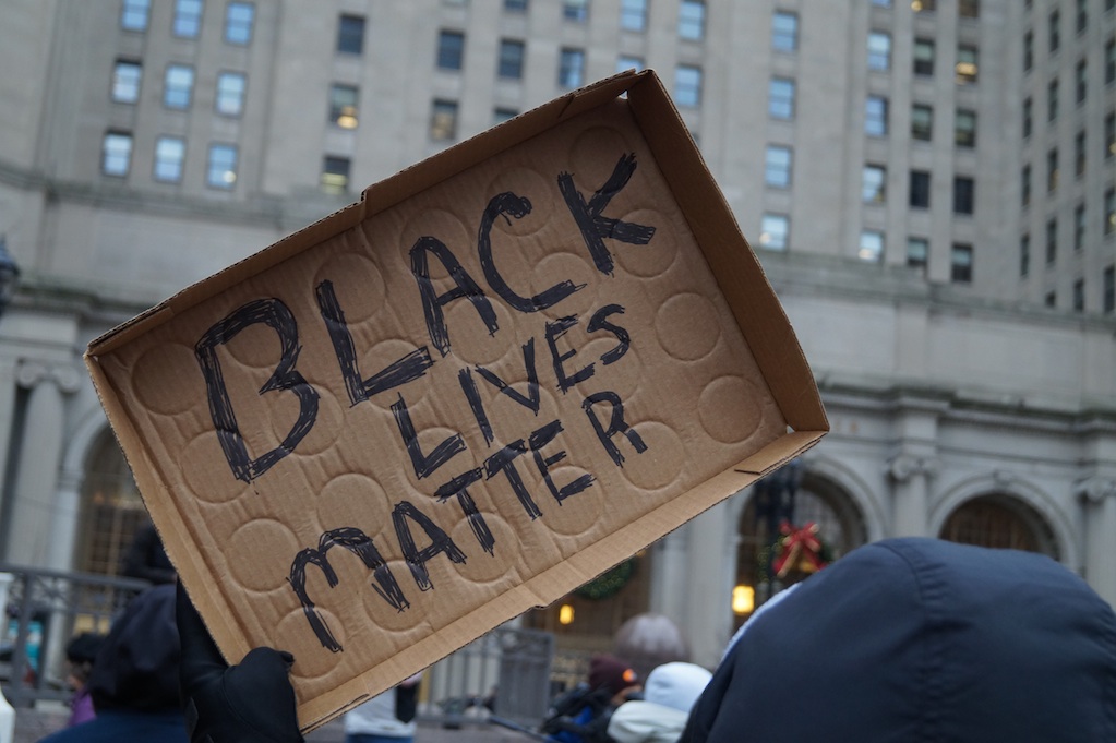
New Report: The Most dangerous and Polluting Plants in Louisiana are in the Areas where Black People Live
/From [HERE] Thirty years ago, a report called out Louisiana’s petrochemical industry for building plants in areas with a large Black population. On Monday, a new update to the report found that little had changed, and new plants in the state’s chemical corridor are still disproportionately planned near Black communities, according to an analysis by a New Orleans-based environmental justice nonprofit.
The Deep South Center for Environmental Justice’s new report builds on its research from the 1990s, mapping out locations of polluting facilities in the chemical corridor.
After plotting the sites of more than 100 plants against Census data, a clear pattern emerged: most of the facilities sat in areas that were 40% to 60% Black.
Three decades later, the center mapped the chemical corridor again and found that the trend has only continued along the 85-mile stretch of the Mississippi River between New Orleans and Baton Rouge. Overall the amount of pollution has decreased, but plants are still being planned in areas with a large Black population, and the risk of cancer and other health problems remains high.
The region itself also has a higher proportion of Black people than in the ‘90s, according to 2020 Census data. In areas like St. Charles Parish, the majority of plants sat in mostly white communities in 1990, but now the biggest polluters are “primarily” in areas with a 52% to 65% Black population.
“Nothing has changed. The data is still there. In fact, it's getting worse,” said Deep South Center of Environmental Justice founder Beverly Wright during a news conference Monday.
The 2023 update to those 1990 maps analyzed Environmental Protection Agency data on greenhouse gas and toxic air emissions overlaid with demographic data. The center worked with Intellectual Concepts, LLC to compile it. [MORE]